

Developing Your Park
Trail Building
JUMP TO:


MORE DEVELOPMENT SECTIONS:
TRAIL BUILDING
Best Practices & Helpful Resources
Conservation areas and urban parks, no matter where they are located, generally rely on a trail network for recreation and travel throughout the park. Whether you’re out for a rugged hike, a run, or casually exploring the community’s green spaces, well-designed trails are the backbone of outdoor recreation.
Trails can be built for connections between parks and neighbourhoods, for access to picnic areas and playgrounds, or for cross country skiing, mountain biking and hiking, passive recreation or just for exploring your urban green spaces. Trails also provide significant cultural, health and wellness benefits.
Each trail type has different development and maintenance needs, and there are best practices you can use to successfully develop each.

Many of the following tips for building great trails are from Meewasin Valley Authority, the ASUPCA member with over 100 km of multi-use trails. They have significant experience planning and building multi-use urban and rural trail networks to accommodate different uses and terrains.
The Saskatchewan Trail Association, and Trans Canada Trails are both great resources to help you develop your own trail network.
Trail networks benefit from well established guidelines for construction based on usage, location, and accessibility requirements. Guidelines provide consistency for users and for developers.
Consider the following when developing a guiding document for your trails:
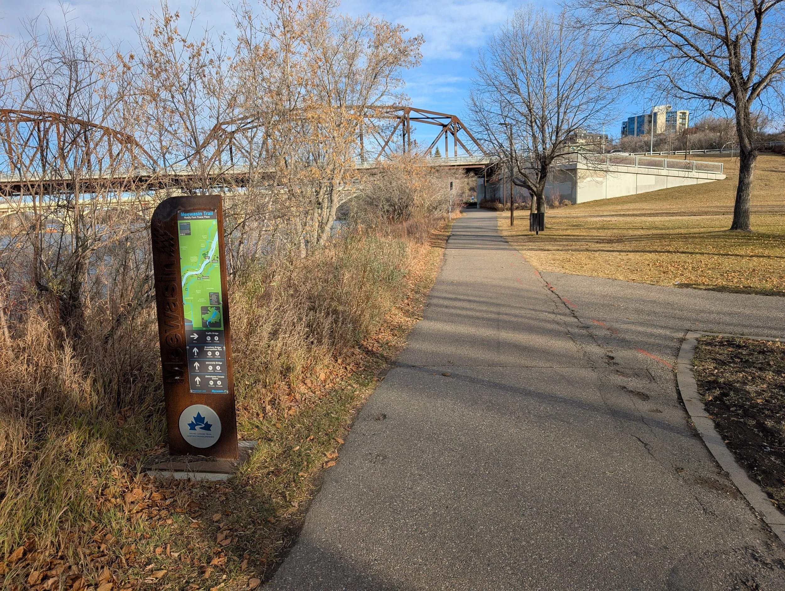
Meewasin Trail Rotary Park, Saskatoon
Meewasin Trail, Gabriel Dumont Park, Saskatoon
The amount and type of traffic you expect for your trail should inform the width of the trail, as well as the surface type. Multi-use and high use trails should be wide enough to accommodate cyclists, those on mobility devices, and people travelling on foot, Grades are important considerations for persons with reduced mobility, both the longitudinal and cross slope.
Paved trails are best for accessibility.
Crusher dust and mowed trails are better suited for more rugged and natural areas where the biggest concern is conserving sensitive areas and keeping users on formalized paths.
Surfaces & Widths

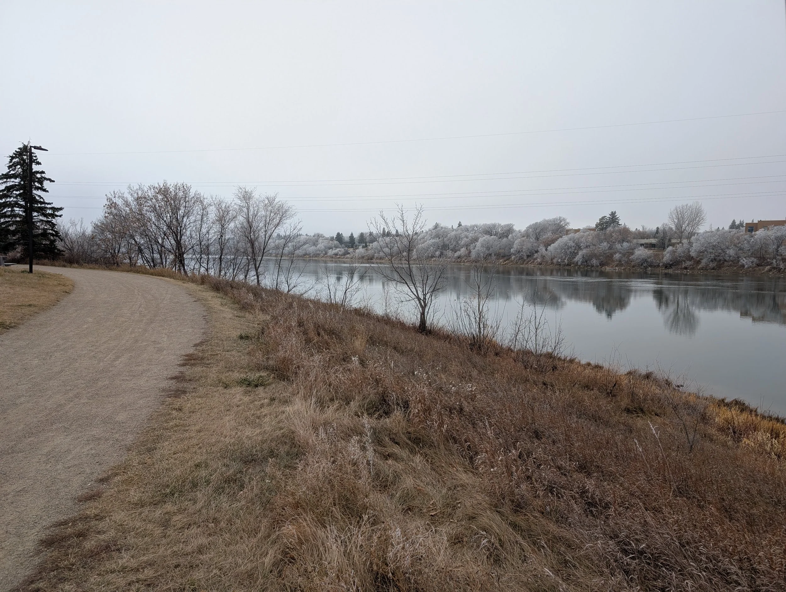
Meewasin Trail, Gabriel Dumont Park, Saskatoon

Battleford River Valley Pee Gee Man Trail, North Battleford
Trails through conservation areas and parks should be engaging, and allow users to experience the park as fully as possible. Trail design should take advantage of interesting sightlines, landscapes and views - opportunities for lookout points, and seating areas - while also safely accommodating flow through traffic. Trails should be designed to blend into the landscape and provide points of discovery and interest.
Sightlines
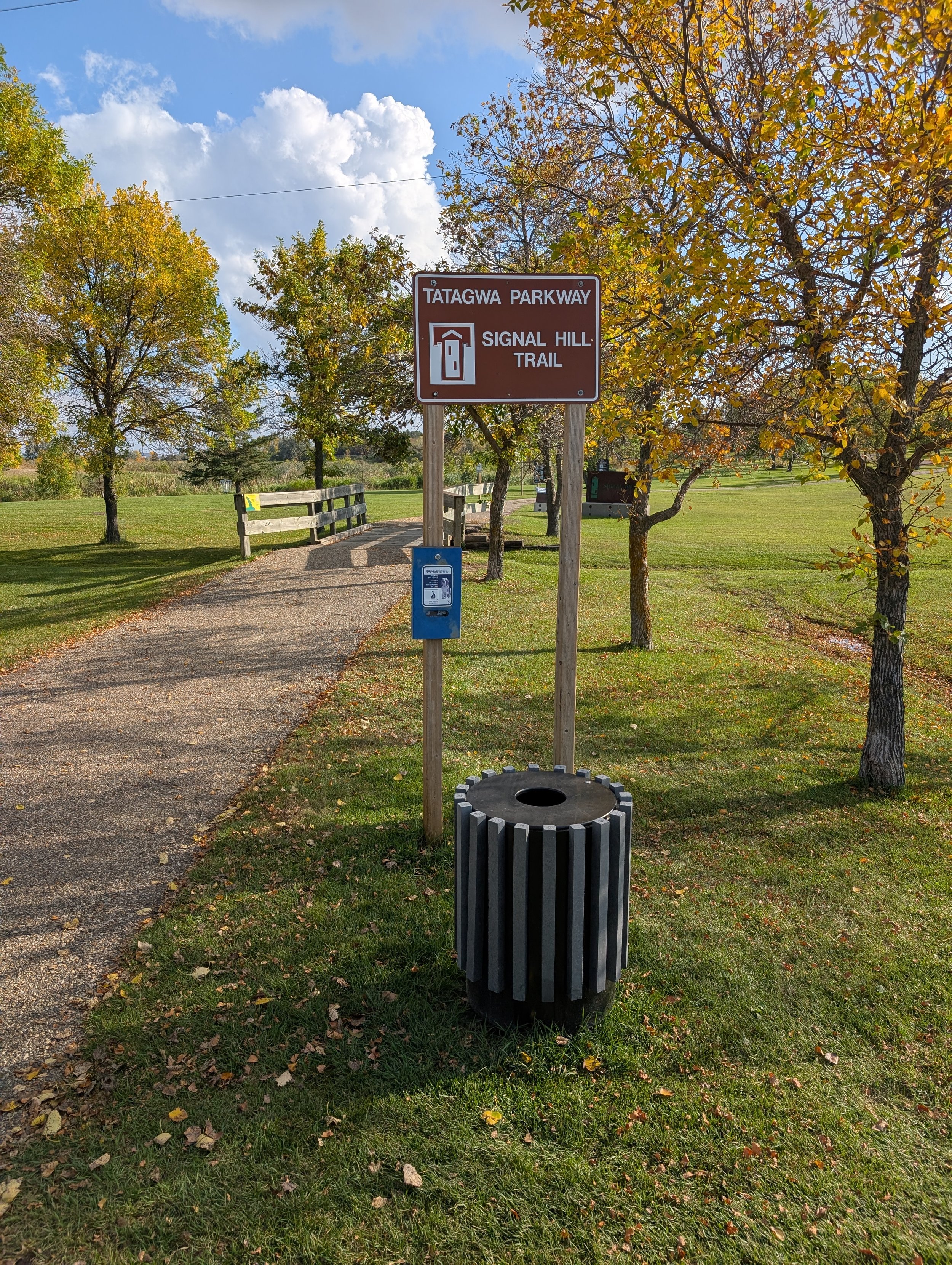
Tatagwa Parkway Trail, Weyburn

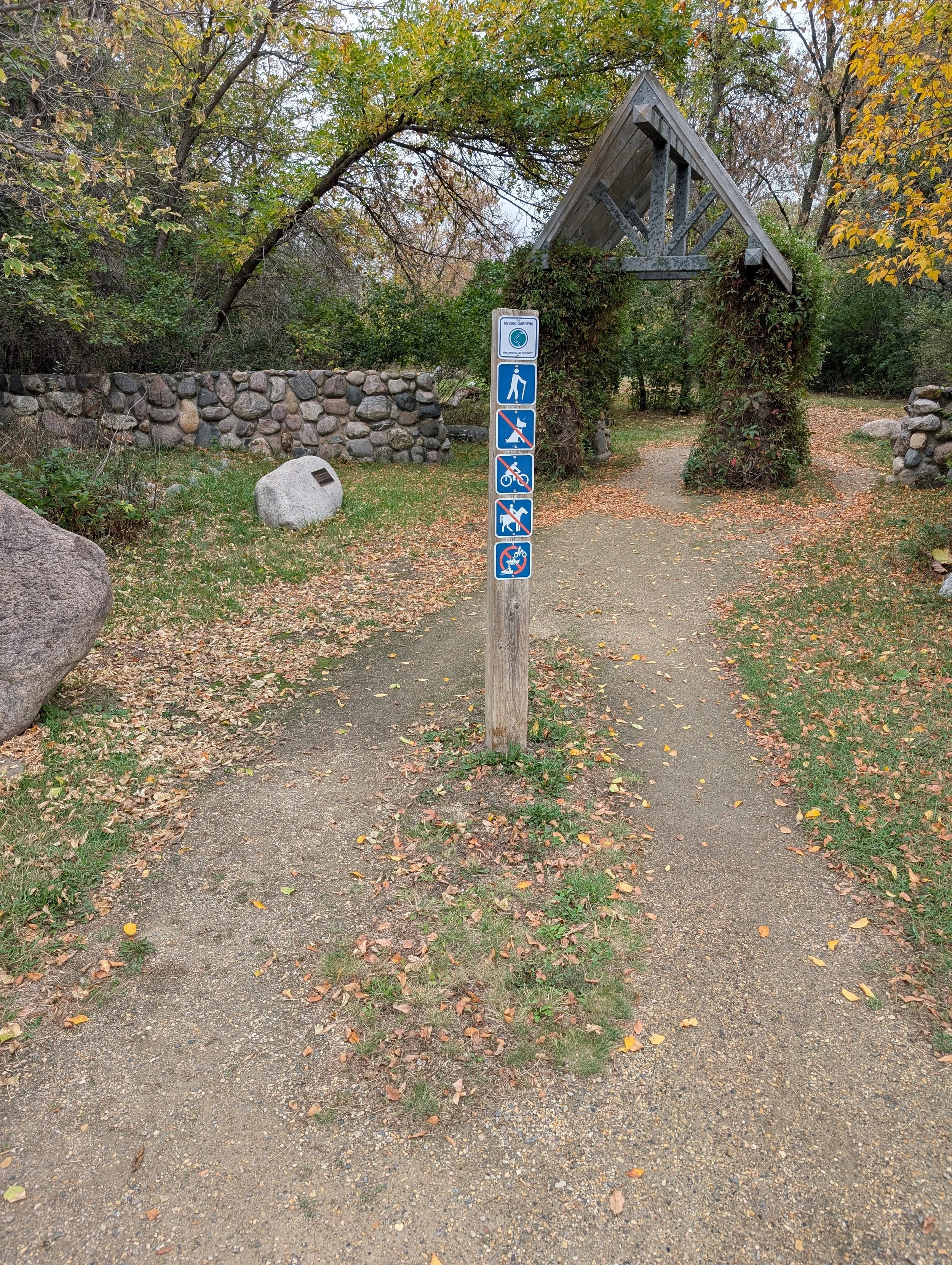
Kiwanis Memorial Park, Meewasin Valley, Saskatoon
Trails should be built to accommodate as many user abilities as possible. Some park areas might be more suitable for different amenities than others, but consider trail ratings for difficulty, resting point frequency and configuration, restrooms, drinking fountains, covered areas for inclement weather, points for refuse containers, and information signage.
More rugged or rural trails may have fewer stopping points and refuse containers; high traffic and accessible urban trails would have more frequent rest stops and picnic areas nearby.
Amenities & Access
Information and regulatory signs are important considerations for trail users, and should be made as accessible as possible. Provide information on trail difficulty, width, slopes, length, maps, amenities, barriers, restrictions on use, and points of contact between pedestrian and motorized vehicle traffic. Signs should also indicate if a trail surface changes ahead to warn users well in advance. Trails need signs that clearly indicate how to stay safe while out on the trails.
Signage
Wakamow Valley Wayfinding Sign
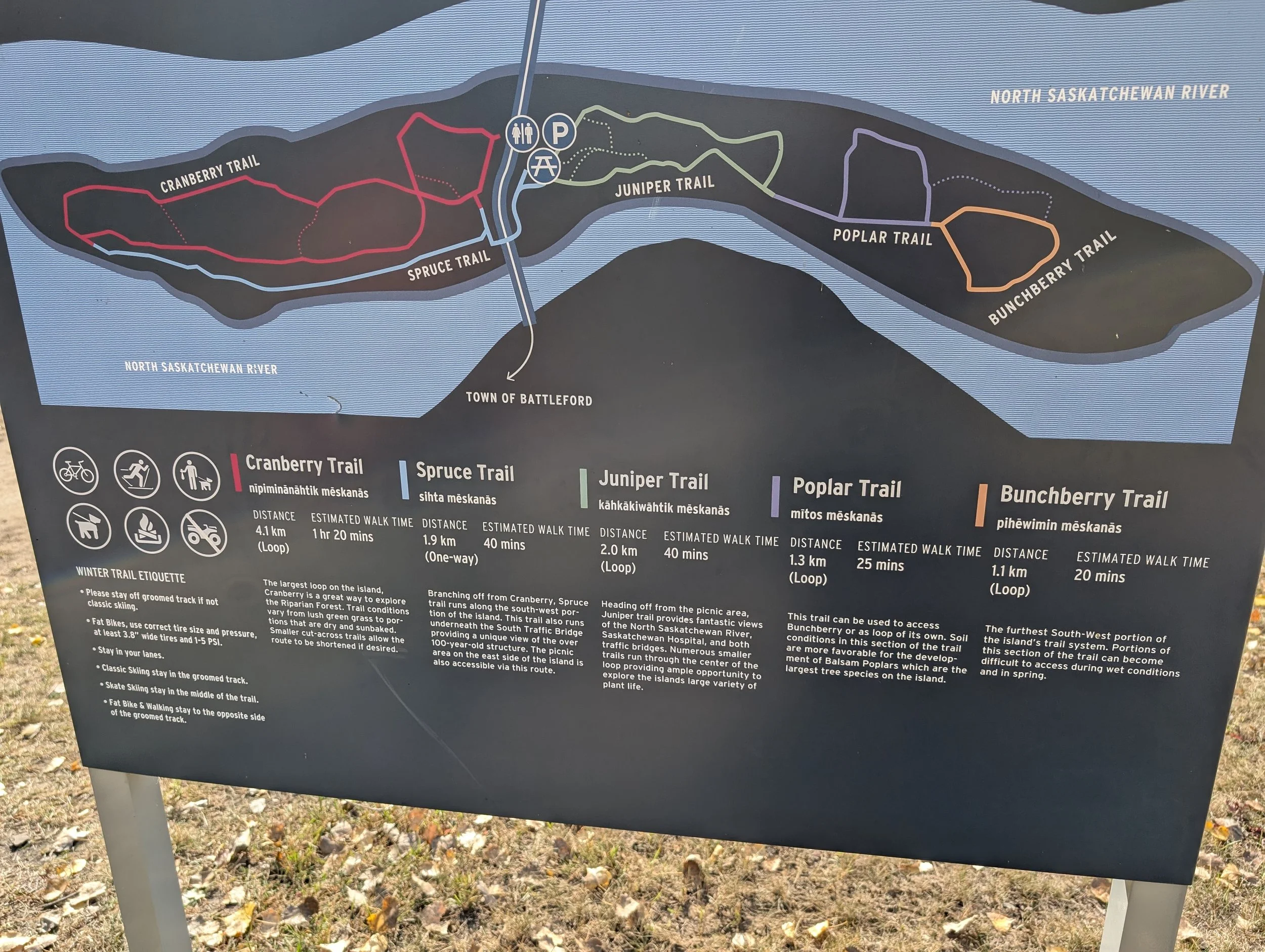
Battleford River Valley Cross Country Ski Trails Map

Little Red River Park Warning Sign

Little Red River Park Multi-Use Trail, Prince Albert
Your trail corridor is the trail and the landscape through which it travels. An interesting trail corridor has proximity to vegetation where users can interact with nature, both plant and animal, but does not allow vegetation to impede passage or impact sightlines.
Be mindful of vegetation overhang in the trail corridor, as well as vegetation that could grow over the trail itself. Consider vertical and horizontal clearance when developing trails and through maintenance best practices.
All amenities are best located outside of the flow of traffic and adjacent areas need to be sufficient to accommodate drainage and snow storage. Clearance around curves should be increased to reduce blind spots and trails should be kept clear in locations with reduced visibility.
Corridors
Whether for the safety of trail users along roadways or waterways, or for the protection of ecologically sensitive areas from the impact of users, appropriate buffers and access control measures can support trail use without significantly affecting adjacent landscapes or sightlines. Low posts (bollards), boulders and even vegetation beds that provide obvious separation can discourage users from leaving the path.
Buffers


Battleford River Valley Parking Lot Buffer
Wakamow Valley Park Buffer Fence

Little Red River Park Amenity Buffer
These are just a few of the trail guidelines to consider as you plan your trail network. You may wish to consider maintenance, snow removal, trail comfort in summer, wind breaks, and how to manage slopes and erosion as part of your trails as well. Understanding trail usage is also helpful for trail planning. Trail counters or other data sources can inform future trail planning and development.
Consider hiring a consultant to help you develop a trail development guideline document of your own.

CHECKLIST ITEM
Consider developing a trail development guideline or standards for your community. It can help with consistency, safety, and budgeting. Many good examples are available for reference.
Covered Picnic Area, Tatagwa Parkway, Weyburn